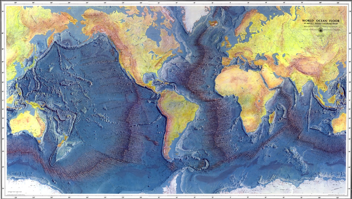
The collaboration with the National Geographic Society also led to maps of the ocean floors starting in 1966. In co-operation with the pioneer of oceanography Prof. Bruce Heezen of Columbia University, New York, and his assistant Marie Tharp, maps of all the ocean floors were created. This co-operation culminated in the famous World Ocean Floor map done in 1977 for Columbia University and the U.S. Navy.
Ocean Floors, World Map 1975-1977
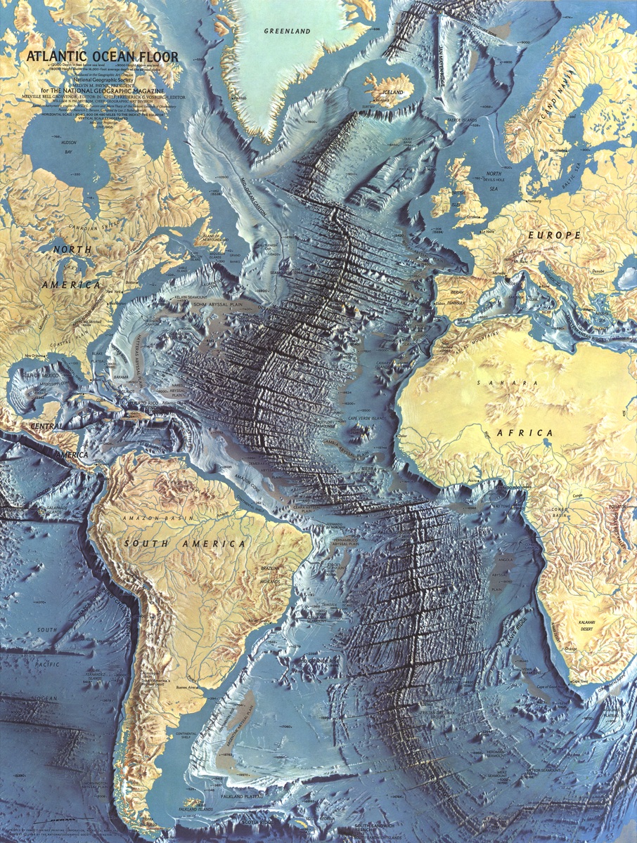
Ocean Floor: Atlantic 1967
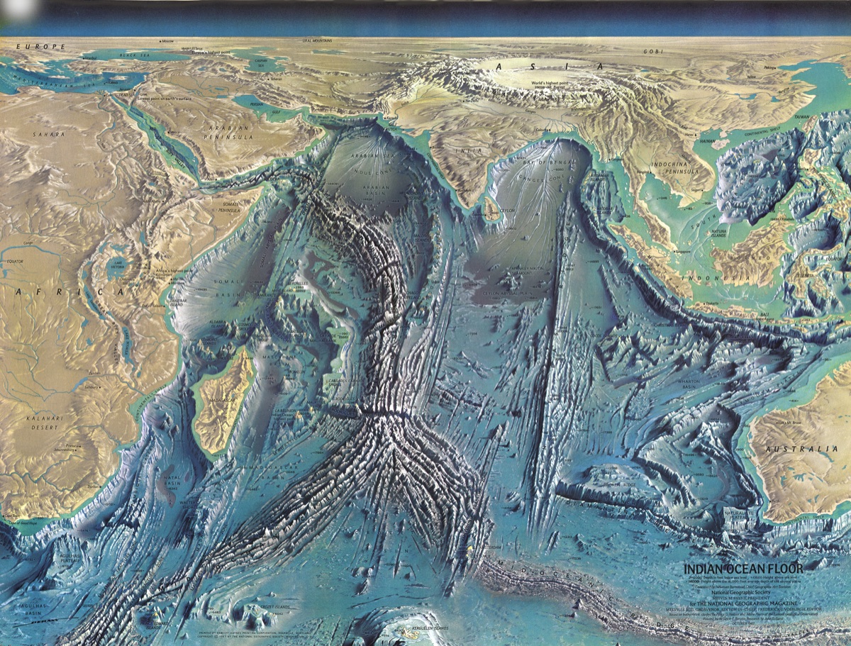
Ocean Floor: Indian Ocean 1965
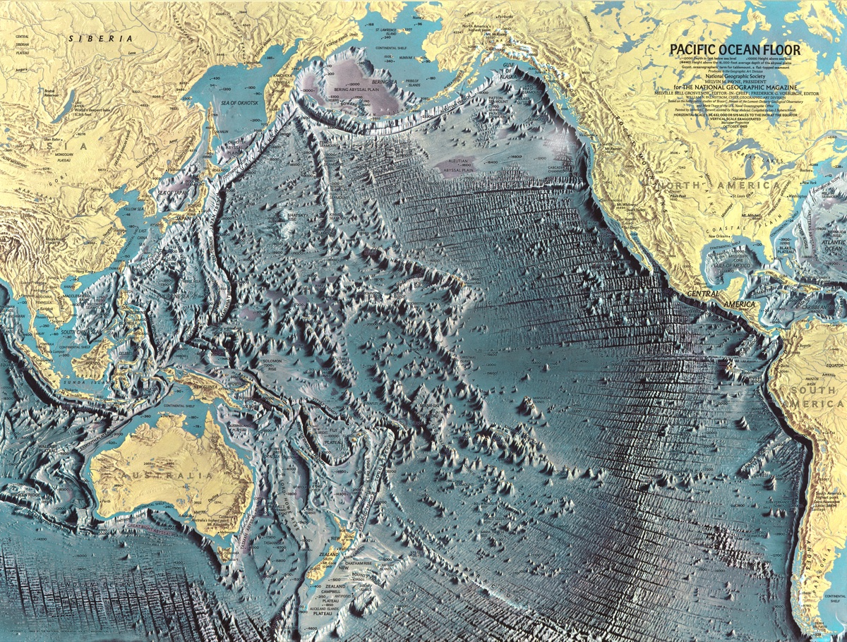
Ocean Floor: Pacific Ocean 1969
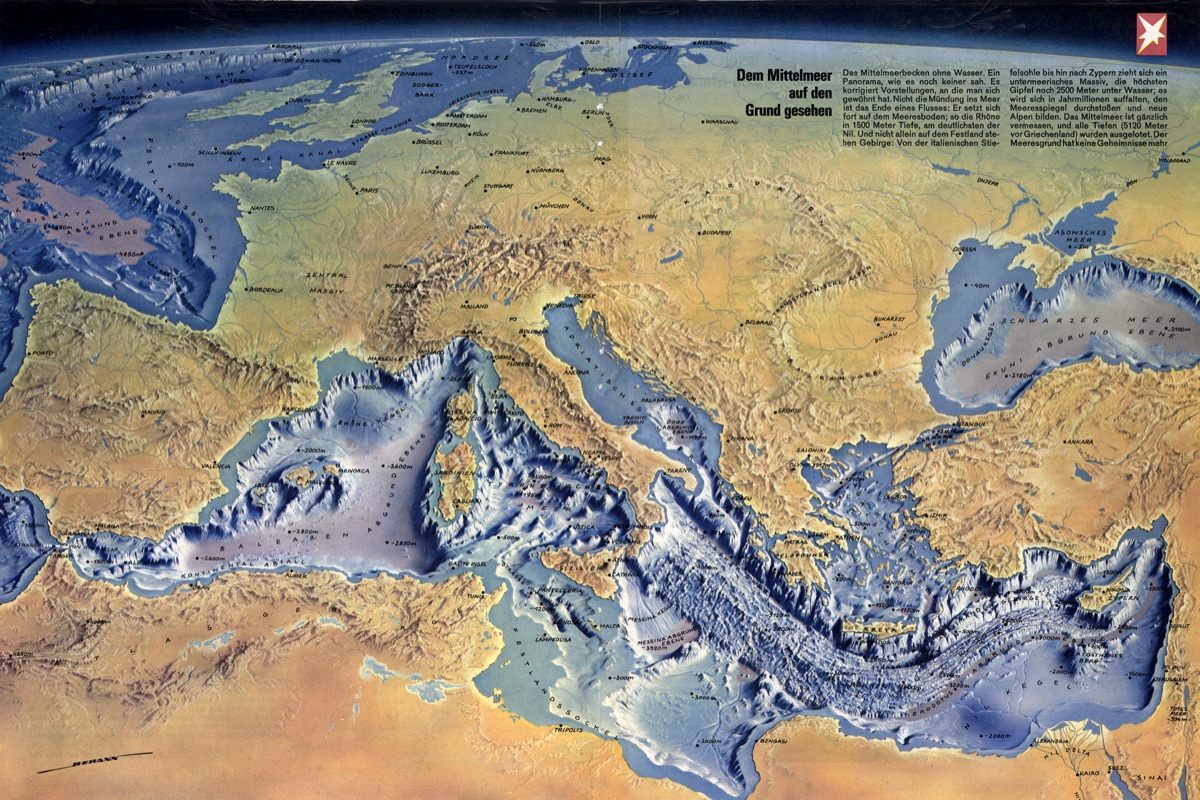
Ocean Floor: Mediterranean 1970
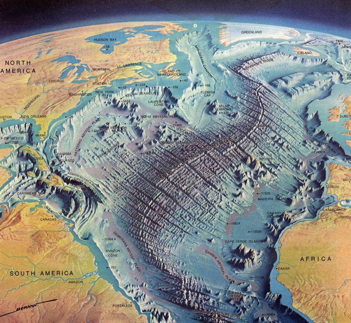
Ocean Floor: North and Central Atlantic 1968
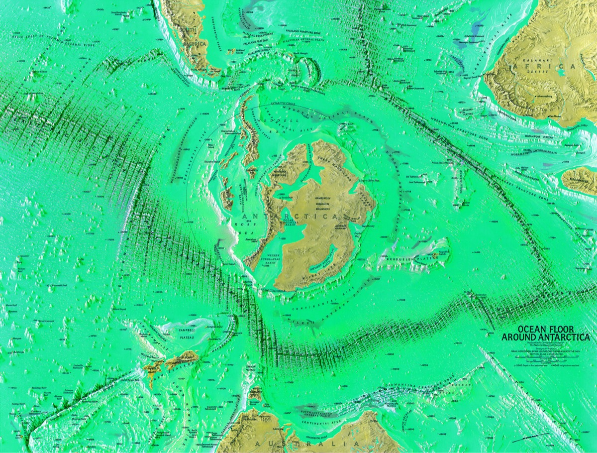
Ocean Floor: Antarctica 1972
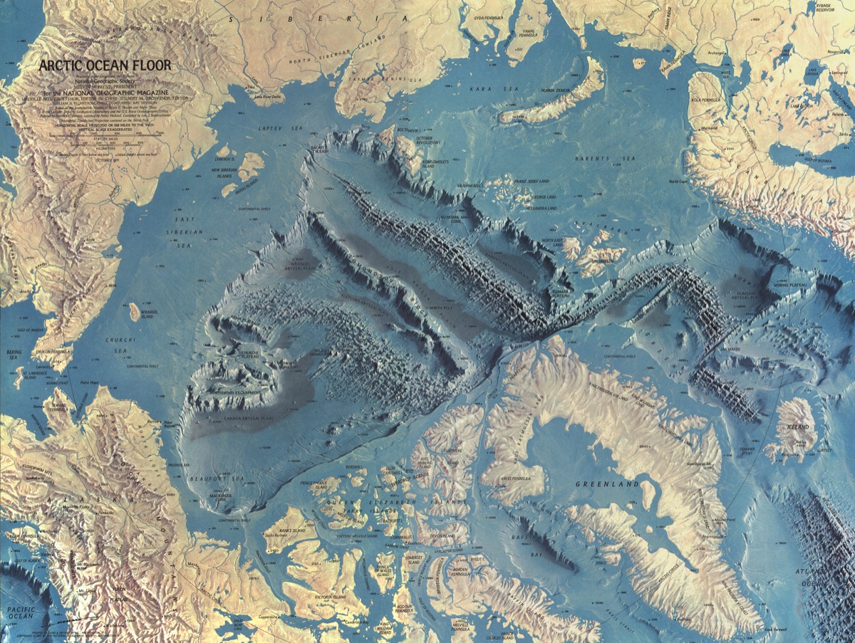
Ocean Floor: Arctic 1971
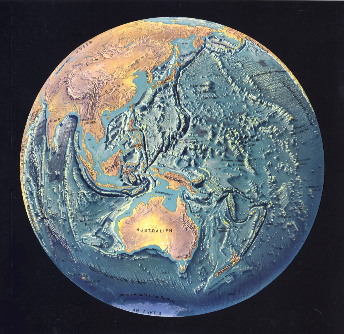
Ocean Floor: Pacific Hemisphere 1969
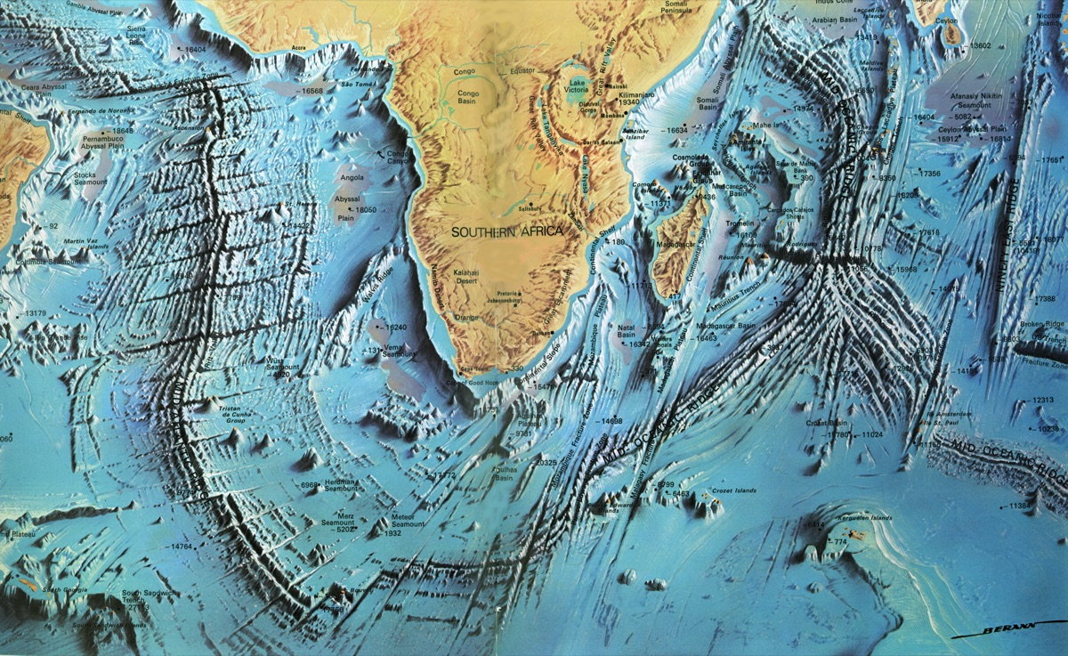
Ocean Floor around South Africa 1970