The Panorama Maps
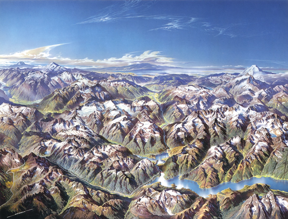
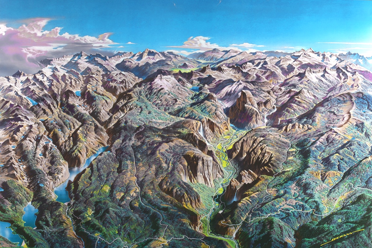
Prof. H.C. Berann is famous worldwide for his unique panorama maps that combine old European painting tradition with modern cartography. Over six decades he created hundreds of panoramic masterworks spanning Alpine tourism, Olympic Games, ocean floors, and national parks.
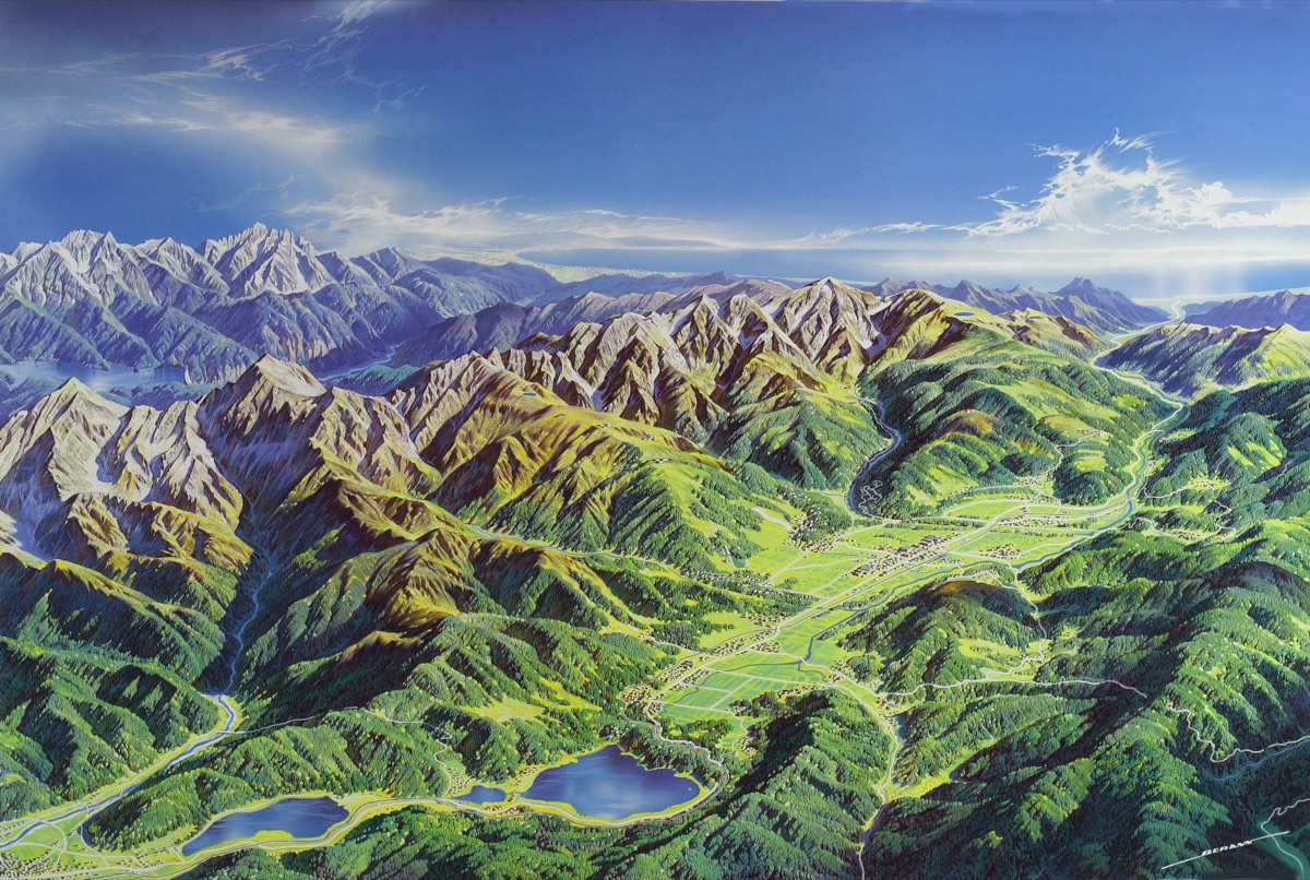
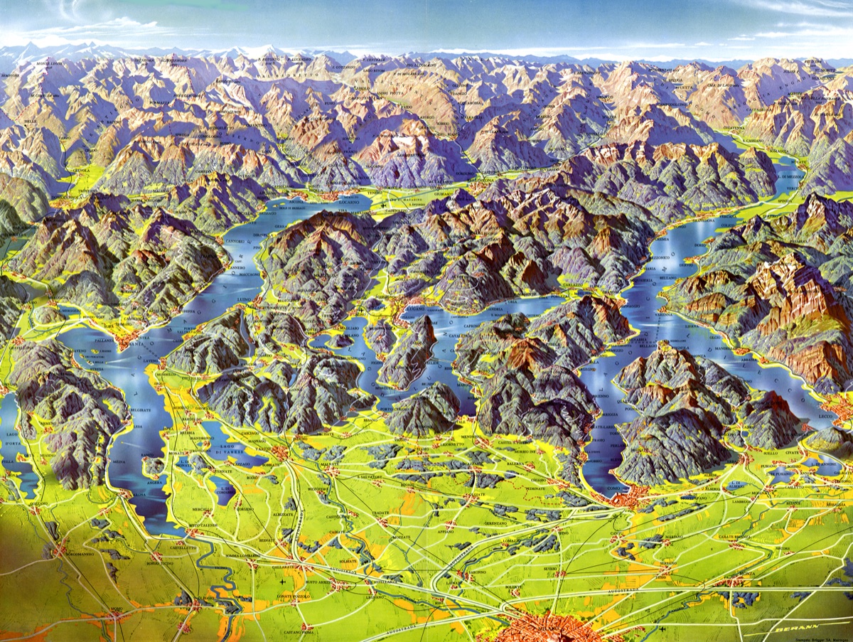
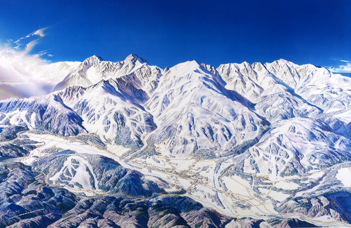
The Touristic Maps
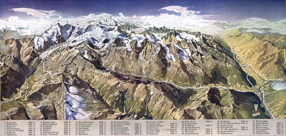
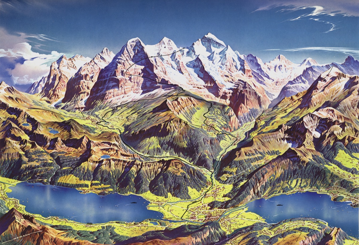
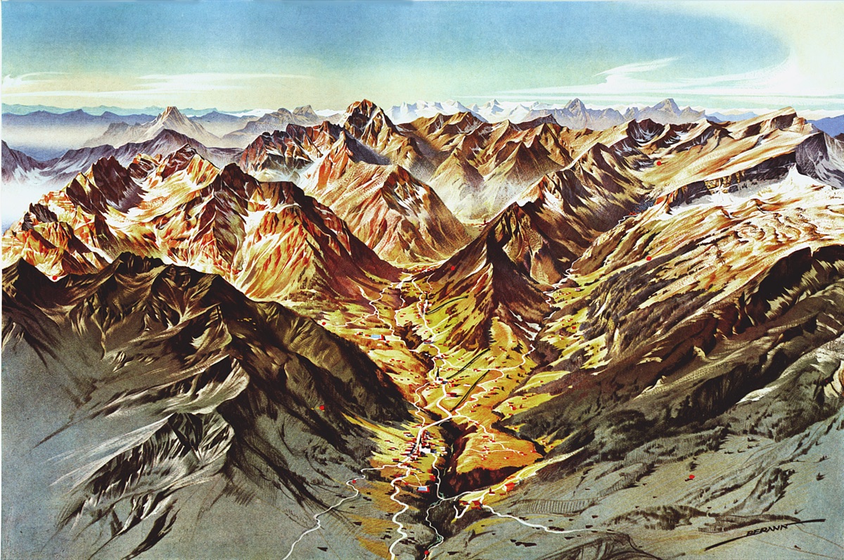
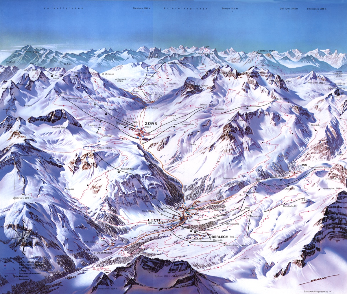
Berann's career as a panorama cartographer began in 1934 when he won first prize in a competition for a panorama map of the newly opened Großglockner Hochalpenstraße mountain pass road in Austria. His first foreign map followed in 1937 for the Jungfraubahn mountain railroad in Switzerland. After the Second World War, hundreds of further maps followed — for ski resorts, Alpine regions, and tourist destinations across Europe and beyond.
The Olympic Maps
Berann created panoramic maps for several Olympic Games host locations: Cortina (1956), Rome (1960), Innsbruck (1964 and 1976), Sarajevo (1984), and Hakuba/Nagano (1998). These maps captured the dramatic mountain and urban landscapes of each host city with his signature artistic style.
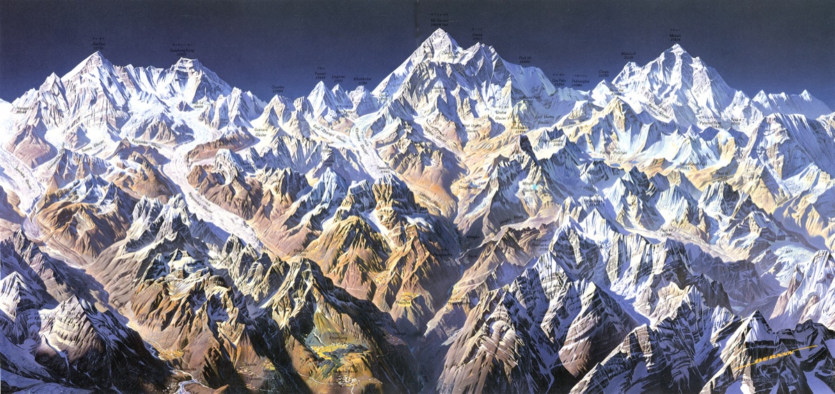
Maps for the National Geographic Society
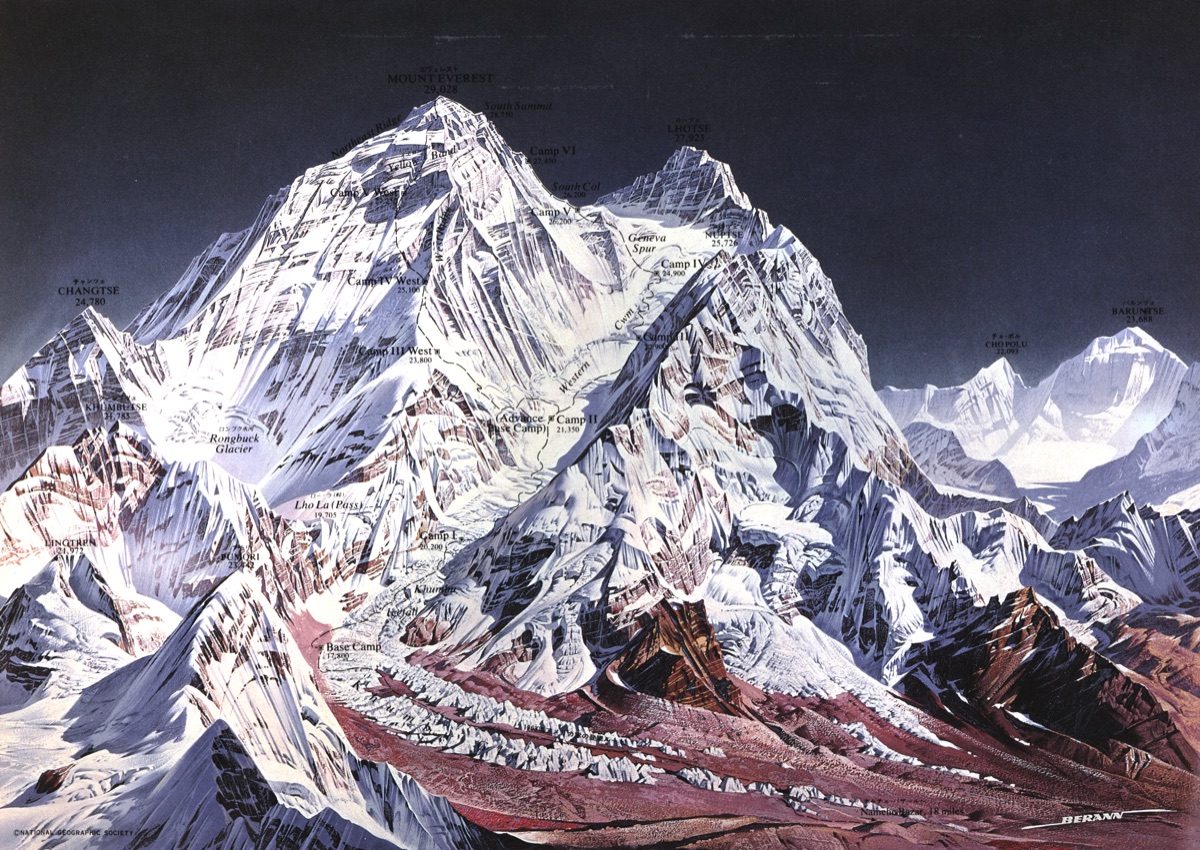
It did not take long and his fame spread overseas, where the National Geographic Society became aware of his talent and asked him to paint two Himalayan maps in 1963: an overview of Khumbu Himal and a map of Mt. Everest. A fruitful collaboration over many years followed.
The Ocean Floor Maps
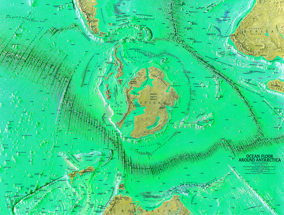
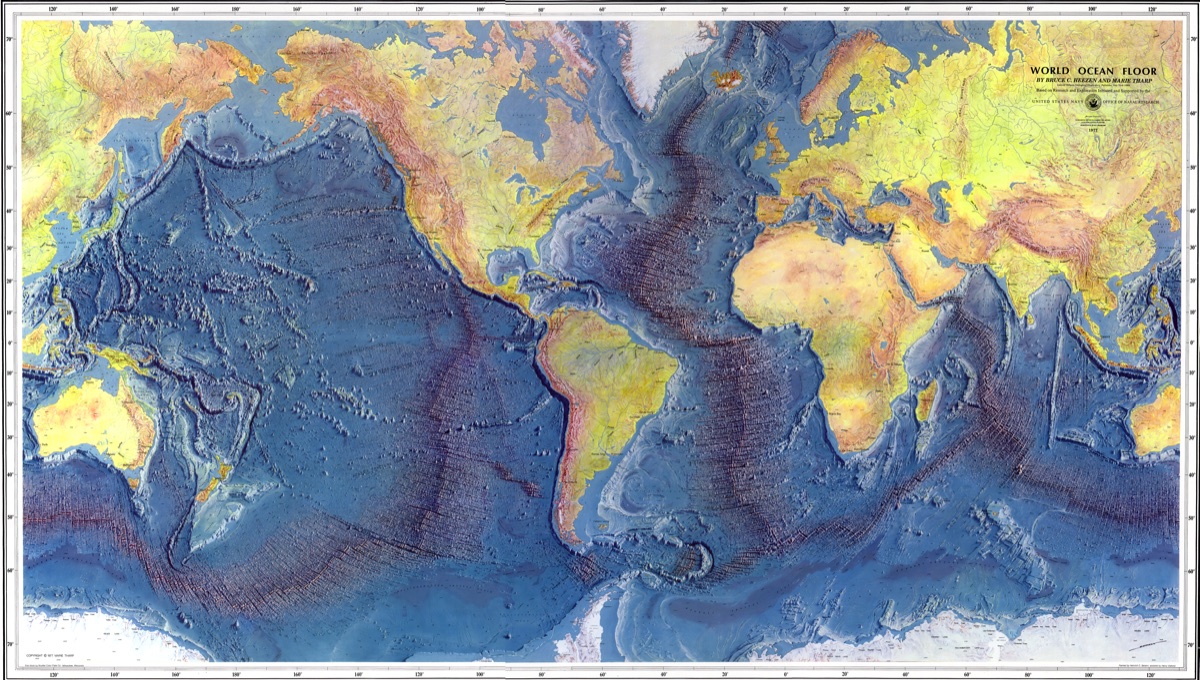
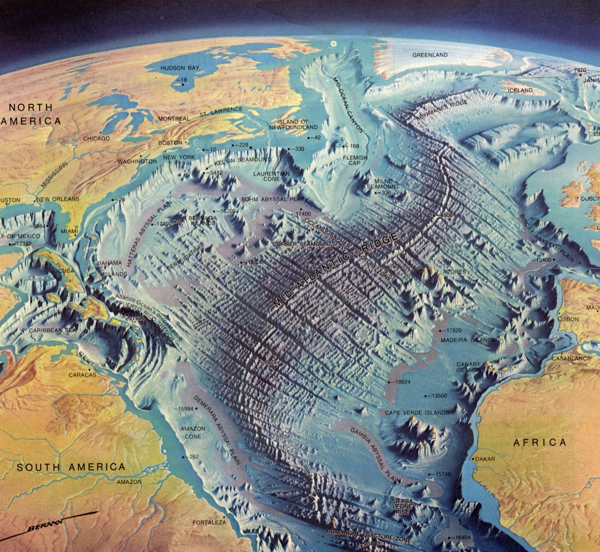
The collaboration with the National Geographic Society also led to maps of the ocean floors starting in 1966. In co-operation with the pioneer of oceanography Prof. Bruce Heezen of Columbia University, New York, and his assistant Marie Tharp, maps of all the ocean floors were created. This co-operation culminated in the famous World Ocean Floor map done in 1977 for Columbia University and the U.S. Navy.
Other Overseas Maps
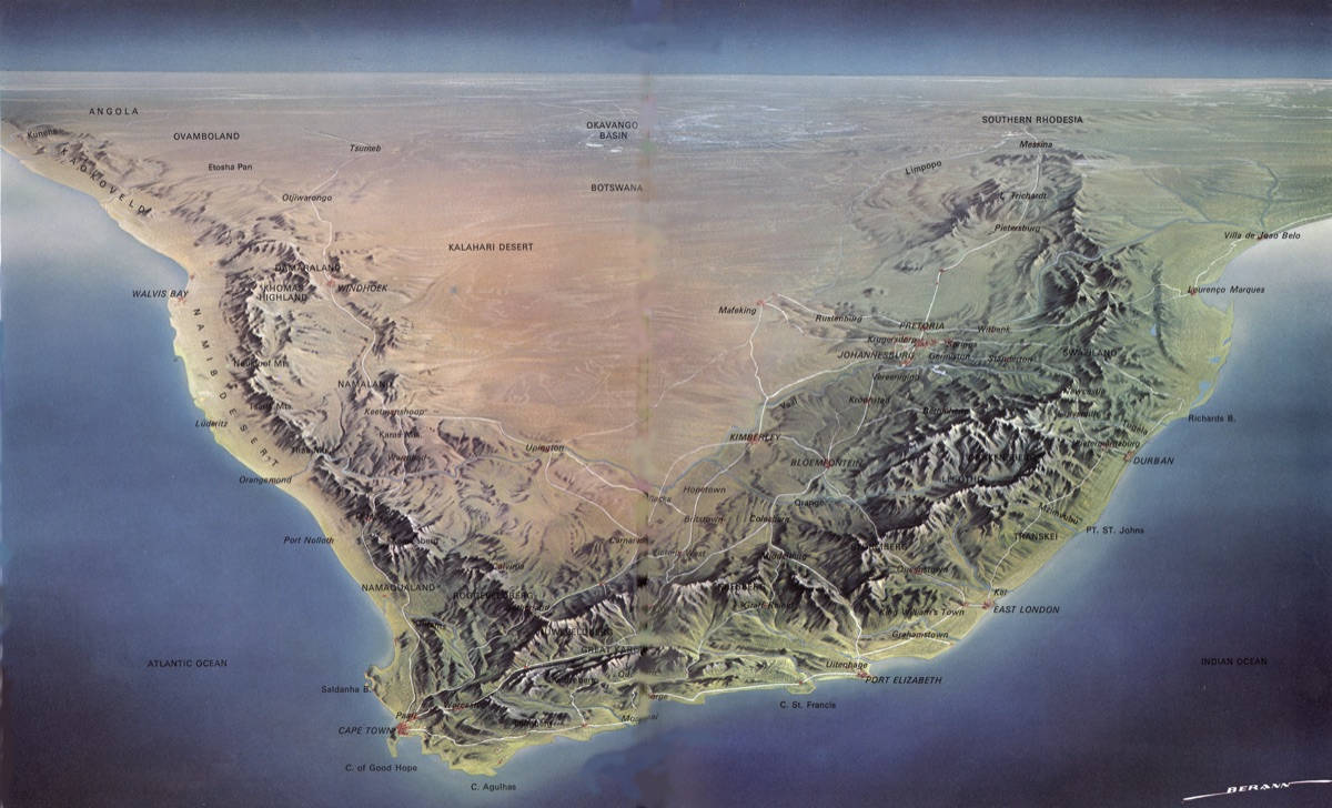
Other overseas contracts were quick to follow, including three maps of South Africa (1976), a map of Mt. Fuji, Japan (1978), and maps for the water pipelines of Mekka-Taif and Riyadh (1983).

Subcontinental and Continental Maps
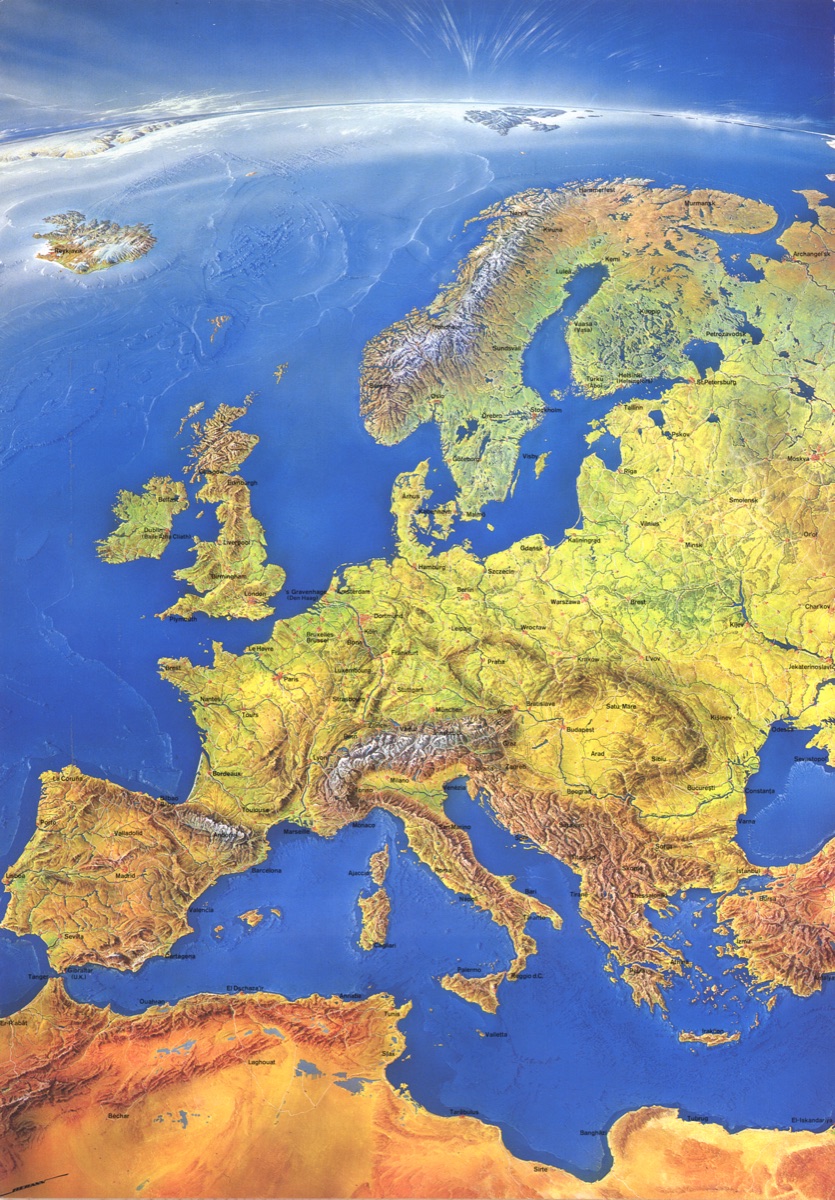
In the last decade of his professional work he painted, besides uncountable maps of tourist resorts, also a few large area maps, including a map of Europe for Mair's Geographischer Verlag (1989), North America (1991), France (1993), and Southern Africa for the South African National Tourist Office (1994).
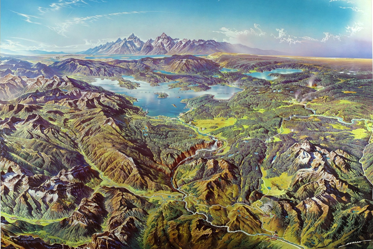
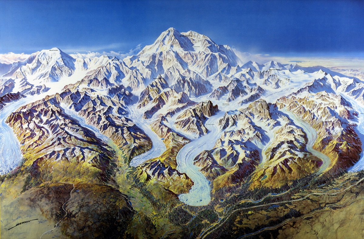
U.S. National Park Maps
A highlight of his last professional decade was a series of maps for the United States National Park Service (1986–1995), concluding with Denali National Park — his final panoramic map after six decades of work.